Skip to content
Menu
TasTrails.com
  • Home
  • The Trails
  • – by Location
    • Central Tasmania
    • East Coast Tasmania
    • Hobart and Surrounding
      • Clarence
      • Hobart City
      • Sandy Bay and Surrounding
      • Wellington Park (kunanyi)
    • Northeastern Tasmania
    • Southern Tasmania
      • Bruny Island
      • Huon Valley & Surrounding
      • Kingborough
      • Mount Field and Surrounding
    • Southwestern Tasmania
    • Tasman Peninsula
    • Western Tasmania
  • – by National Park
    • Cradle Mountain – Lake St Clair
    • Freycinet
    • Hartz Mountains
    • Maria Island
    • Mount Field
    • Mount Williams
    • South Bruny
    • Southwest
    • Tasman
    • Walls of Jerusalem
    • Wild Rivers
  • About / Contact
    • About Tastrails
    • Contact Us
    • Disclaimer and Privacy Policy
    • Our Flickr
    • Safety
    • Information Key
TasTrails.com

Platypus Bay

Posted on November 24, 2014September 30, 2020

The Trail

Located just north of the visitors centre, the flat 5km return walk to Platypus Bay provides hikers with opportunities to view native plants such as banksia, tea tree and wattles while scouting shores of Lake St Clair.

From the visitors centre at Cynthia Bay the trailheads first to Watersmeet 1.5km away, where the Cuvier and Hugel rivers join before feeding into Lake St Clair. After crossing the Watersmeet bridge, the trail curves to the right and leads towards the lake. Soon after, Platypus Bay and the platypus viewing hide are passed. If you are patient and quiet enough, you may be able to spot the local platypi during twilight hours.

Continuing on, the sandy shore of Lake St Clair is reached next. This is a suitable location of a break. From the lake’s edge the track briefly climbs to meet the Overland Track. At the junction, follow the trail to the left to return Watersmeet and then on to visitors centre.

Getting There

View Google Map Directions From Hobart, head north on Brooker Avenue, taking the first exit just before the Bridgewater Bridge onto the Lyell Highway, continue for 140km to Derwent Bridge. Once at Derwent Bridge turn right onto Lake St Clair Rd. The Platypus Bay Trail begins just behind the main Parks and Wildlife Building.

Trail Map

Platypus-Bay

Map for illustrative purposes only. Base map supplied by Land Information System Tasmania
Photos
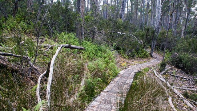
Platypus Bay trail
Platypus Bay trail
Platypus Bay trail
Platypus Bay trail
Platypus viewing area
Platypus viewing area at Platypus Bay

View more Platupus Bay photos

Quick Search

Trail Location

Nearby Trails

  • Walls of Jerusalem
    King Solomon's Throne from Mount Jerusalem
  • Liffey Falls
  • Overland Track
    Lake Windermere, The Overland Track
  • Platypus Bay
  • Shadow Lake Circuit
©2021 TasTrails.com | Powered by SuperbThemes & WordPress